« Modèle:Géolocalisation/France » : différence entre les versions
Aller à la navigation
Aller à la recherche
m Corr. |
Optimisation du code |
||
| Ligne 1 : | Ligne 1 : | ||
<includeonly>{{Géolocalisation/Projection bilinéaire | <includeonly><!-- | ||
VERSION OPTIMISÉE | |||
-->{{#switch:{{{1}}} | |||
|y={{#expr: ({{{2}}}-(51.50))*-0.0915238095238}} | |||
|x={{#expr: ({{{3}}}-(-5.80))*0.0632911392405}} | |||
|image=France location map-Regions and departements.svg | |||
|image2=France_location_map-Regions.svg | |||
|image3=France_location_map-Departements.svg | |||
|image4=France_relief_location_map.jpg | |||
|iwidth=2000 | |||
|iheight=1922 | |||
|name=France | |||
|zone=pays | |||
|geo=-79 | |||
|top=51.50 | |||
|bottom=41.00 | |||
|left=-5.80 | |||
|right=10.00 }}<!-- | |||
VERSION NON OPTIMISÉE (pour mémoire) | |||
{{Géolocalisation/Projection bilinéaire | |||
|{{{1}}}|{{{2}}}|{{{3}}} | |{{{1}}}|{{{2}}}|{{{3}}} | ||
|top=51.50 | |top=51.50 | ||
| Ligne 7 : | Ligne 30 : | ||
|image=France location map-Regions and departements.svg | |image=France location map-Regions and departements.svg | ||
|image2=France_location_map-Regions.svg | |image2=France_location_map-Regions.svg | ||
|image3=France_location_map-Departements.svg | |||
|image4=France_relief_location_map.jpg | |||
|iwidth=2000 | |iwidth=2000 | ||
|iheight=1922 | |iheight=1922 | ||
| Ligne 12 : | Ligne 37 : | ||
|zone=pays | |zone=pays | ||
|geo=-79 | |geo=-79 | ||
}}</includeonly><noinclude> | }}--></includeonly><noinclude> | ||
{{Documentation paramétrage de carte<!--|code=1-->}} | {{Documentation paramétrage de carte<!--|code=1-->}} | ||
<br/> | <br/> | ||
Version du 26 août 2008 à 01:22
Modèle:Documentation paramétrage de carte
Remarques :
- Le code de ce modèle est optimisé ;
- Ces cartes emploient une projection cylindrique équidistante ;
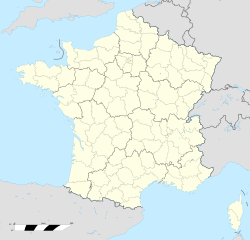
- Quatre cartes (administratives / physique) se superposant parfaitement peuvent être utilisées avec ce modèle.


