Modèle:Géolocalisation/France : Différence entre versions
m (- (redondant)) |
|||
| Ligne 1 : | Ligne 1 : | ||
| − | <includeonly | + | <includeonly>{{#switch:{{{1}}} |
| − | + | |y={{#expr: ({{{2}}} -51.50)*-9.52380952381}} | |
| − | + | |x={{#expr: ({{{3}}} + 5.80)* 6.32911392405}} | |
| − | |||
| − | |||
| − | |y={{#expr: ({{{2}}}- | ||
| − | |x={{#expr: ({{{3}}} | ||
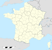
|image=France location map-Regions and departements.svg | |image=France location map-Regions and departements.svg | ||
|image2=France_location_map-Regions.svg | |image2=France_location_map-Regions.svg | ||
| Ligne 20 : | Ligne 16 : | ||
|bottom=41.00 | |bottom=41.00 | ||
|left=-5.80 | |left=-5.80 | ||
| − | |right=10.00 }}<!-- | + | |right=10.00 |
| + | |projection=Projection équirectangulaire | ||
| + | }}</includeonly><noinclude><!-- | ||
VERSION NON OPTIMISÉE (pour mémoire) | VERSION NON OPTIMISÉE (pour mémoire) | ||
Version du 25 octobre 2008 à 23:14
</includeonly>
Modèle:Documentation paramétrage de carte
Remarques :
- Ces cartes emploient une projection cylindrique équidistante ;
- Cinq cartes (administratives / physique) se superposant parfaitement peuvent être utilisées avec ce modèle.
| Les cinq cartes disponibles : | |||||


